Unfettered, legal access to the Owyhee Lava Dam Paper
Courtesy of GSA...
http://bulletin.geoscienceworld.org/cgi/content/full/124/11-12/1667?ijkey=2S9AeWBelZjcY&keytype=ref&siteid=gsabull
P. Kyle House, PhD., Surficial Geologic Mapping Specialist / Geomorphologist
Courtesy of GSA...
http://bulletin.geoscienceworld.org/cgi/content/full/124/11-12/1667?ijkey=2S9AeWBelZjcY&keytype=ref&siteid=gsabull

Usually, I hate the grid. In this case, it may become my friend as I try to figure out where to stop mapping this seemingly tiny part of Oregon.
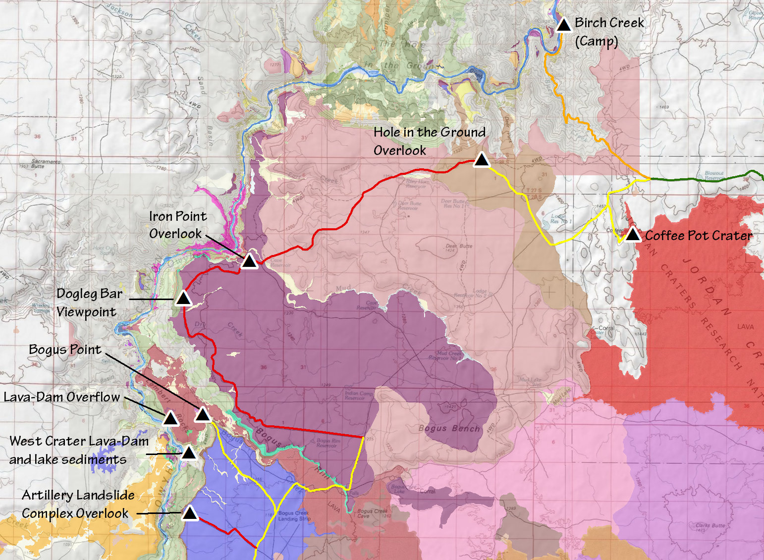
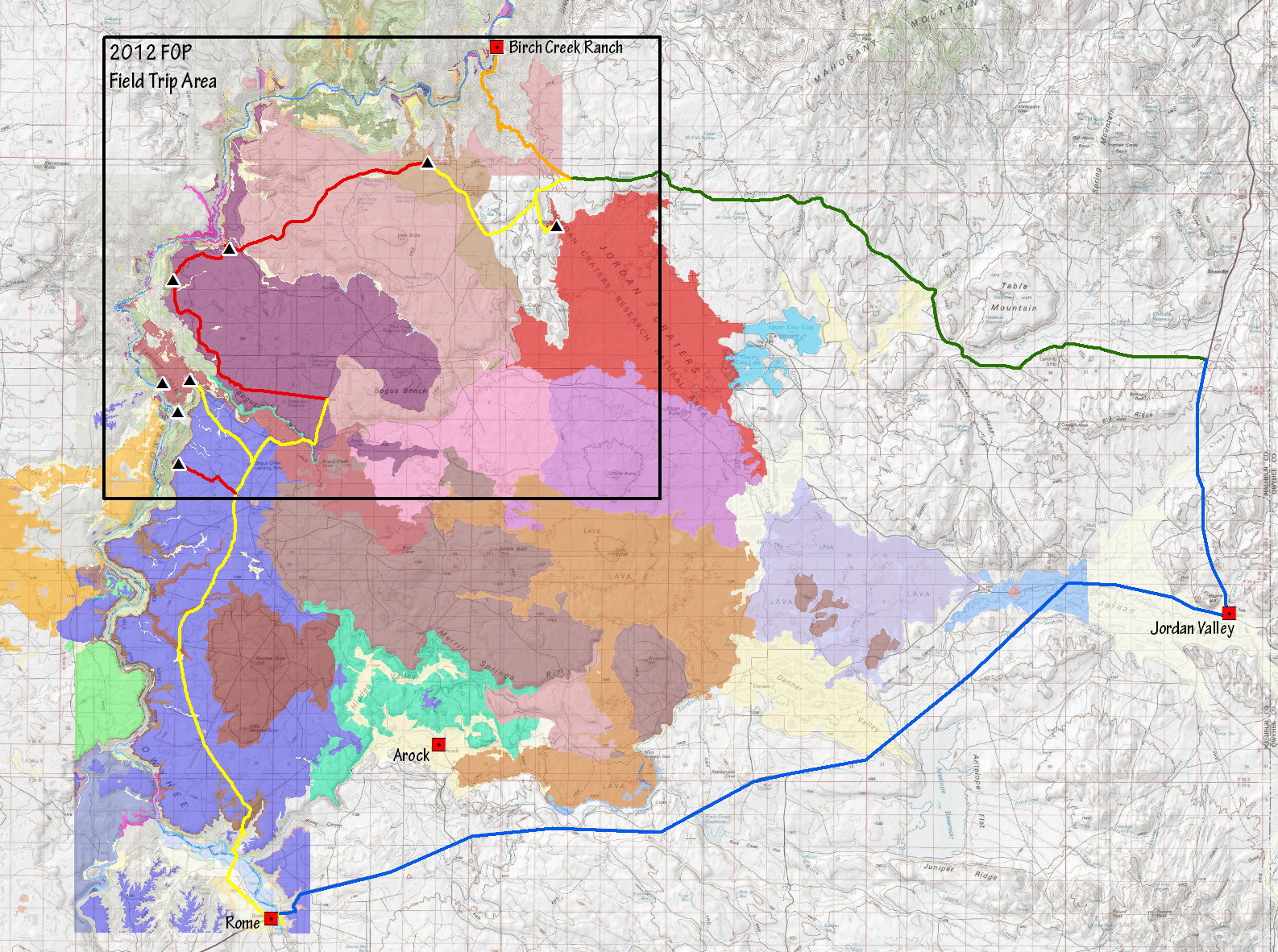
Informal font to accompany informal document. Roads color-coded with respect to their relative ease of travel. Selection of the most obvious sites based on multiple field trips into the area and two instances of leading field camp groups through most of the area in vans.
In terms of logistics, Birch Creek is optimal camp for large group, but does require large backtrack on one of the field trip days. I suppose one possibility is to camp at the Rome put-in on one night. Monkey-wrench? Maybe. However it is pretty easy to blast out of the field area via the southbound route that crosses the bridge north of Rome. In any case, the road network and the site distribution may inspire us to come up with a novel route...give it some thought.
Yep. I am now officially working on that.

Cover photo possibility. A favorite of mine.

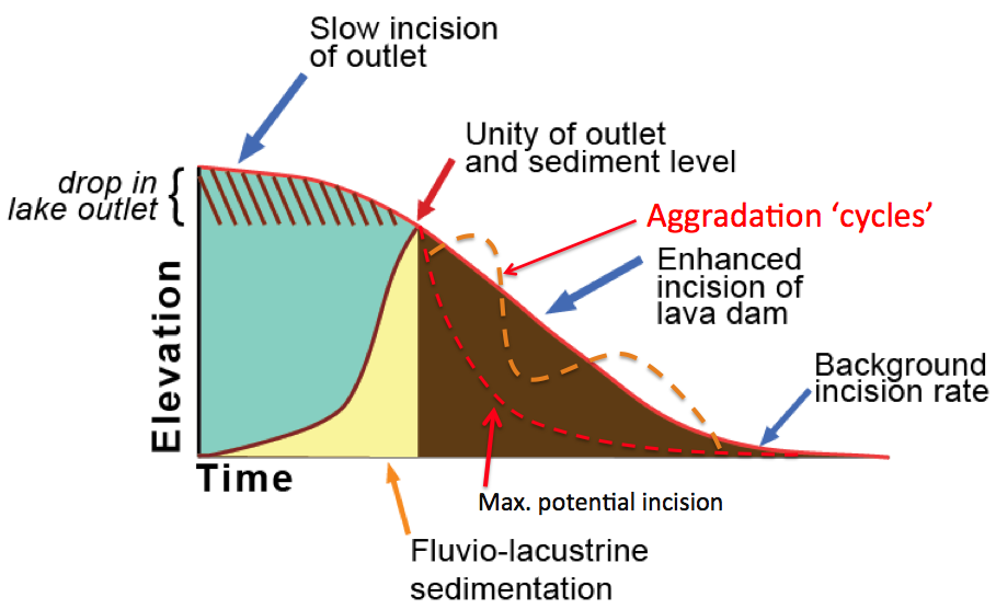
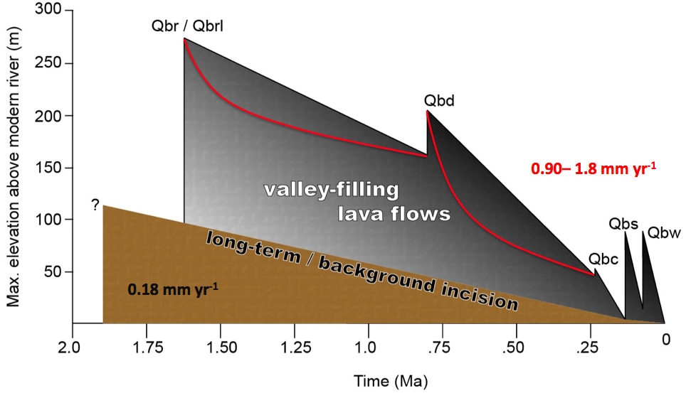
What exactly is up with the profound change in incision rates after the Deer Park lava shows up? Data artifact? Result of averaging over long periods of time? Or the effect of a gargantuan amount of sediment having to be delivered by the river following the demise of the Bogus Rim lava dam(s)?

Not even effing May yet and the flow is about to become bad for rafting. Not happening. Oh well. It is one moody freaking river. That is certain. Next year..?
Some slight, but key alterations.

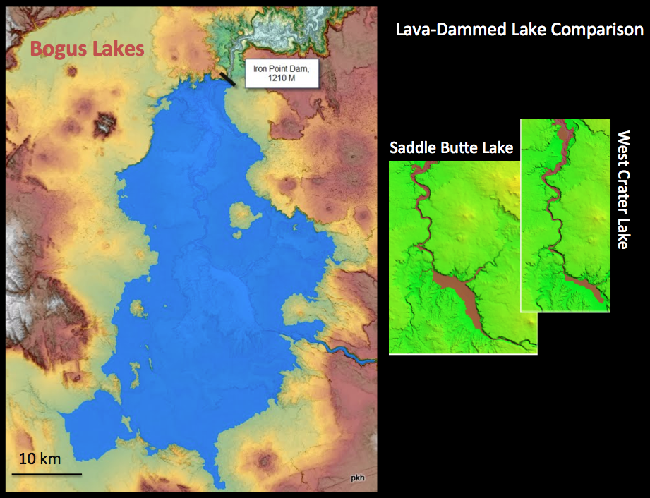
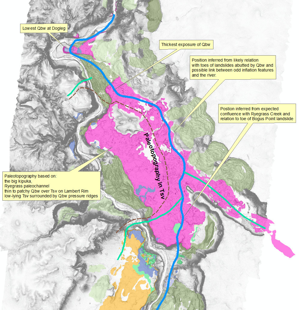
I am grappling with several issues related to the Qbw dam and the
putative lava-dam-lake sediments. More on that later. For now, check
this out. Any viable alternatives?